WHY LOW PRESSURE SYSTEMS HAVE STRONGER WINDS
Why Low Pressure Systems Carry Stronger Winds
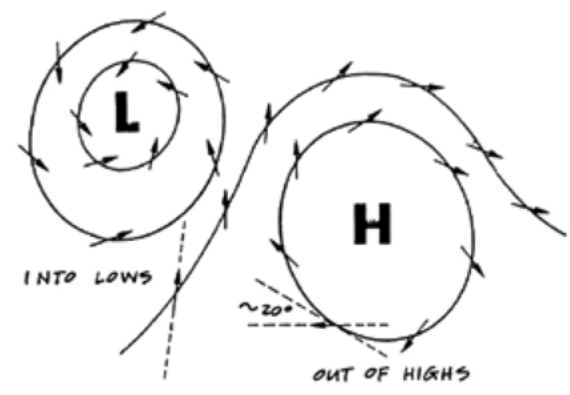
When wind circles a Low, however, the inward force is the pressure gradient (pushing the wind into the Low) and the outward force is the Coriolis force.
Or,
wind circling a Low: Centripetal force = Pressure gradient force - Coriolis force,
and rewriting,
Pressure gradient (Low) = Coriolis force + Centripetal force. T
he important difference between these gradient equations for Highs and Lows is the sign (+ or -) of the centripetal force.
In Lows it adds to the gradient; in Highs it subtracts.
This difference is important because the curvature forces do not vary at the same rate. The strength of the Coriolis force increases in direct proportion to the wind speed, but the strength of the centripetal force required for circular motion increases in proportion to the square of the wind speed.
Winds of low velocity can indeed circle Highs, but as the wind speed increases, the required centripetal force increases faster than the Coriolis force does, so it can’t bend it into a circle.
Since steep circular Highs cannot exist, there cannot be strong winds circling a High. The natural tendency of a circular High is to flatten out. Lows, on the other hand, are just the opposite.
Both terms in the gradient are positive, so the faster the wind goes, the steeper the gradient becomes. In the case of tropical Lows, whenever the wind starts moving in a circle, it accelerates.
These Lows are destined to have strong winds. Once set in motion, they must run their course of continuing to deepen until they run out of fuel.
Since their fuel is warm moist air, this happens whenever they run onto land where the air is drier or when they stop moving and consume all the warm moist air that is available.
(Lows at higher latitudes have other important factors affecting their steepness as discussed in our global weather course .
As a rule, the faster a Low moves, the more intense its winds are. In the summer, Lows travel at some 10 to 20 kts on the average; in the winter they travel typically 20 to 30 kts. In any season, Lows can stop (called stationary Lows), and in the winter they can reach speeds as high as 60 kts.
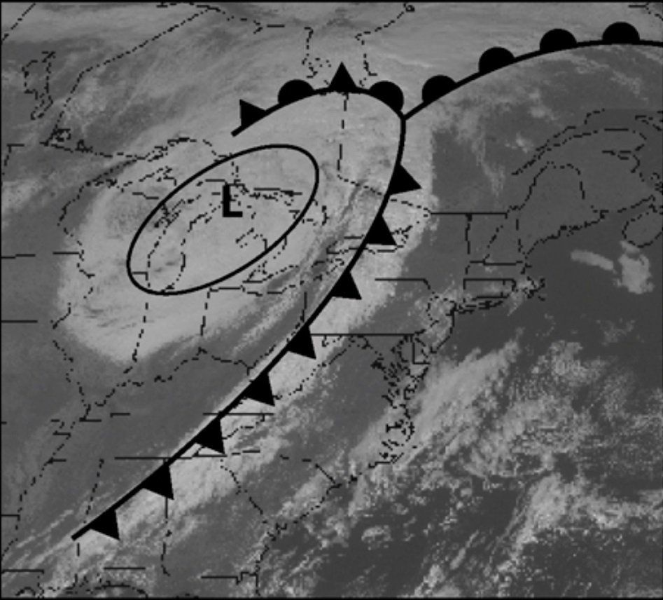
Throughout the midlatitudes (30° to 60°), Lows move eastward across the oceans. In the tropics, low pressure disturbances tend to move westward—a difference that can be traced back to the Coriolis effect. All bad weather systems are low pressure systems.
A storm is a large circular Low; hurricanes and other tropical disturbances are small, intense Lows; frontal systems are long narrow Lows; and squalls are very localized Lows beneath tall cumulonimbus clouds.
Besides strong winds, Lows bring clouds and rain because the air is always rising in a Low.
Clouds form when the rising air cools to the dew point and becomes saturated. When the weight of the water and ice in the clouds can no longer be supported by the updraft of air, it starts to rain.
In Highs, on the other hand, the air is descending, so any clouds that happen into a High will evaporate as they heat on the way down. Highs are characterized by clear skies and light winds.